
On a January night in Hirafu, at the foot of Mount Yōtei, dry snow falls past a queue for wood-fired pizza. The menu is in English. The voices in the queue are Australian, Cantonese, Singaporean and Texan, and the property listings in the windows across the street are written for buyers abroad. A visitor could stand on that corner for an hour and never once be reminded that this is Japan.
Hokkaido in summer is a different island. It is the one the Japanese themselves love most: caldera lakes, the wild coast of Shiretoko, the high country of Daisetsuzan, roads that run empty to the horizon, and the kitchen that feeds the nation. It is the Japan the skiers never see.
the snow
How Hokkaido became a ski island for the world
It began in Niseko, two hours west of Sapporo by road, in the early 2000s. Skiers from Australia found snow there lighter and drier than anything at home, carried in on cold Siberian air that gathers moisture crossing the Sea of Japan and lets it fall on the first mountains it meets. They told their friends. Hong Kong followed, then Singapore, Malaysia and Thailand, and lately the Americans, as the winters of the Alps and the Rockies have grown thinner.
The Hokkaido Government's own counts trace the curve. In the 2010 fiscal year, 741,000 overseas visitors came to the island; in the 2025 fiscal year, 3.3 million came, the highest number on record, by the figures of its Department of Economic Affairs. Singapore, a city of about six million people, sent 61,000 of them, by the same count, against 36,000 from the whole of Europe. The Japan National Tourism Organization counted a record 691,226 Singaporean arrivals in Japan in 2024, and close to one in five of them, 136,250, landed in December, the month the snow settles on Niseko.
The money followed the snow. In the 2024 fiscal year, the Hokkaido Shimbun reported, foreign owners paid 1.28 billion yen in fixed asset tax to the town of Kutchan, home to the Grand Hirafu and Hanazono slopes, against 1.15 billion yen from Japanese owners: the first time foreign owners had paid the larger share. By December 2025 the town counted some 4,200 foreign residents, a record. And in the 2025 fiscal year Americans became the largest group of foreign overnight guests in the Niseko area for the first time, overtaking the Australians and the visitors from Hong Kong who had led for years, according to the Niseko Promotion Board.
In January, parts of Niseko and Furano are hard to recognise as Japan at all. That is exactly why they are not where the Japanese go.
the open country
Hokkaido as the Japanese know it
The Brand Research Institute in Tokyo began ranking the prefectures in 2009, asking tens of thousands of Japanese each year which one they find most attractive. Hokkaidō has come first in every survey. The 2026 survey, published in October, made it eighteen years in a row, with Kyōto second.
What they mean by it is not powder snow. To a family in Tokyo or Osaka, Hokkaidō is the summer island: dry and cool while Honshū sits under the heat, the one region of the country for which the Japan Meteorological Agency declares no tsuyu, the long rainy season of June and July, and above all open. Hokkaidō covers about 22 per cent of Japan's land and holds about 4 per cent of its people, by the figures of the Ministry of Land, Infrastructure, Transport and Tourism, which puts its population density at a fifth of the national average.
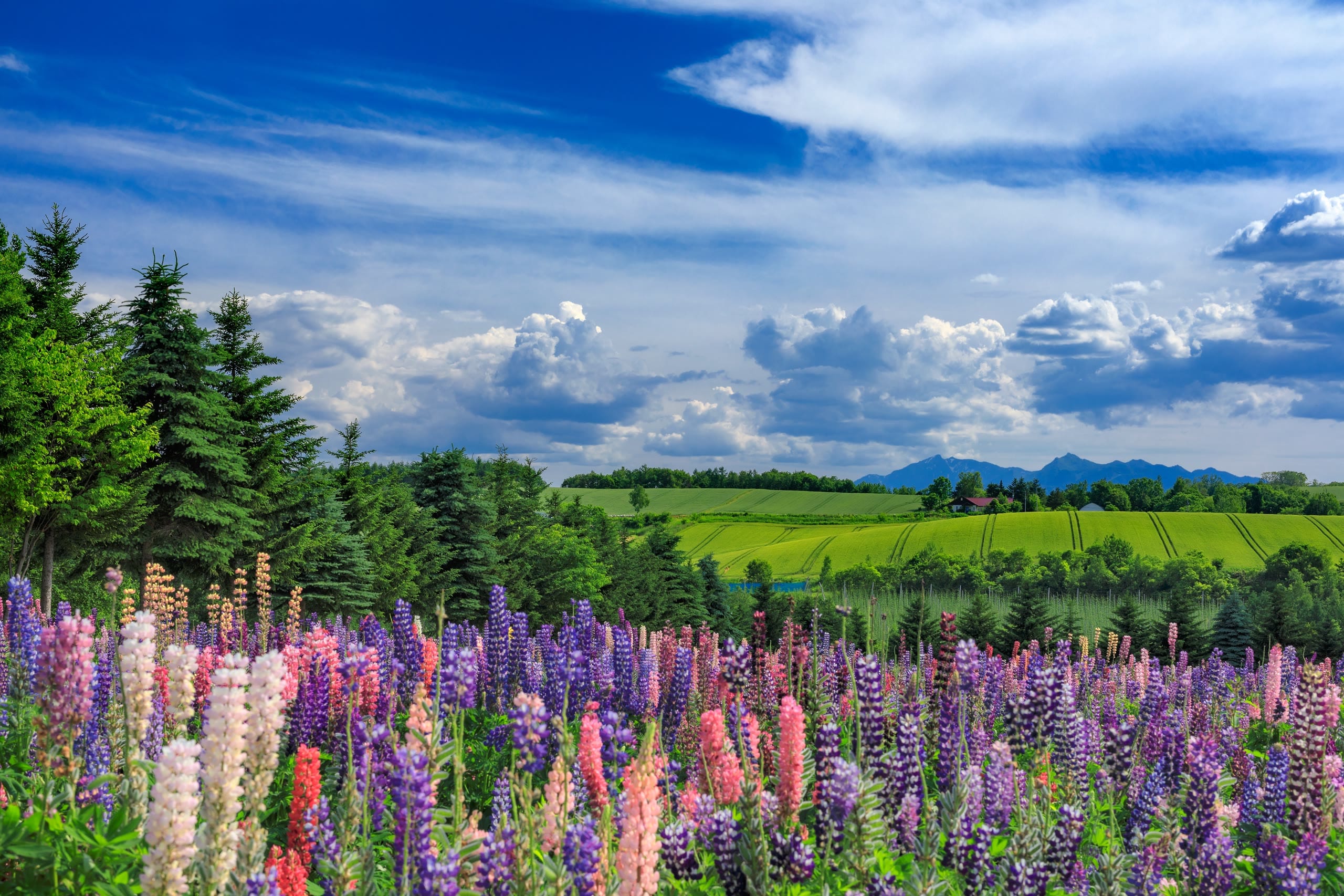
Most of Japan is a mountain country, its cities pressed into narrow plains between ridge and sea, every valley floor long since given to rice and roofs. Hokkaidō is where the land opens into wide open spaces. The Tokachi plain runs flat and gold with wheat to a horizon ruled by windbreaks of larch. The Konsen plateau in the far east is dairy pasture as far as the eye carries. Between Biei and Asahikawa the road rolls over hills of potato flower and barley with nothing taller than a silo in sight, and outside Shari, on the Okhotsk side, a road the Japanese call the Road to Heaven runs dead straight for some twenty-eight kilometres until it appears to lift into the sky. This is the Japan that Tokyo drives to in July with the windows down.
the wild
Caldera lakes, Shiretoko and Daisetsuzan
The two largest national parks in Japan are both on this island, by the Ministry of the Environment's measure. Hidaka Sanmyaku Erimo Tokachi, designated in 2024, covers 245,668 hectares of ridge and forest running south to Cape Erimo. Daisetsuzan, second at 226,764 hectares, is the roof of Hokkaidō, a high plateau of volcanic peaks where Asahidake, the island's tallest mountain at 2,291 metres, keeps patches of old snow and drifting steam among its alpine flowers through the summer. The Japan Edition's guide to Daisetsuzan on foot follows its trails.
East of it, Akan Mashū National Park sets three calderas into forest. Kussharo, some eighty square kilometres of water, is the largest caldera lake in Japan. Mashū fills its crater to the brim, one of the clearest lakes in the world, and is seen only from the rim, through the mist that gives it its other name, the lake of fog. Akan keeps marimo, the velvet-green spheres of algae that grow on its bed.
South of the lakes lies Kushiro Shitsugen, the largest wetland in Japan and, in 1980, the country's first Ramsar site: reed bed, peat and slow river to the edge of sight, where the red-crowned crane raises its young in summer.
At the island's north-eastern tip, the Shiretoko Peninsula runs out into the Sea of Okhotsk, inscribed as a UNESCO World Heritage Site in 2005 for the meeting of sea and forest at the lowest latitude in the Northern Hemisphere where seasonal sea ice forms. Much of it has no road. Its far coast is seen from the water, cliffs falling straight into a cold green sea, waterfalls dropping from the forest edge into the surf.
None of this is a ski run. It is untamed country in the plainest sense of the word, and in summer it belongs to the Japanese.
the table
The kitchen of Japan
They also come to eat. Hokkaidō produces more than half of Japan's milk, by the statistics of the Ministry of Agriculture, Forestry and Fisheries, and the cold seas around it land the crab, sea urchin and scallops that all Japan orders by name. In summer the uni comes in from Shakotan and Rishiri, sweet and cold; hairy crab comes from the Okhotsk ports, scallops from Sarufutsu and Tokoro. Yūbari melon, orange-fleshed and grown under glass in an old coal town, is given as a gift across Japan in a box fit for jewellery.
Ramen divides by city: miso in Sapporo, a clear salt broth in Hakodate, soy in Asahikawa. Lamb sizzles on domed iron pans as jingisukan, named for Genghis Khan, the dish of a summer evening in a Sapporo beer garden. And the dairy, from soft-serve at a farm stand outside Biei to the butter and cheese of the Tokachi plain, tastes of the grass beyond the window. The Japan Edition's guide to the food of Hokkaidō takes the table dish by dish.
the second journey
Hokkaido after Tokyo and Kyoto
For an American who has already done Tokyo and Kyōto, the usual next step is another city on the same rail line. Hokkaidō is the contrast. Where Kyōto folds twelve centuries into a single street, Sapporo was laid out on open ground in the 1870s, with Horace Capron, a former United States Commissioner of Agriculture, among the advisers brought in to plan the new capital and its farms. Where Tokyo is density itself, the drive from Asahikawa to Shiretoko crosses a day of forest, lake and pasture. The temples give way to caldera lakes, the bullet train to a private car, the formal kaiseki counter to a crab boiled at the harbour. It is Japan, unmistakably, in its manners, its bathing and its food, and it is the Japan the first journey never reaches.
Luxury Japan Travel was the first to offer luxury summer tours of Hokkaido to international guests.
The Summer Tour of Hokkaido spends twelve days in the west and centre of the island: the lavender of Furano and the fields of Biei, two nights on the shore of Lake Shikotsu with a full day of relaxation in a suite with its own open-air onsen at the water's edge, the fireworks over Lake Tōya watched from the onsen on the terrace, cold sea urchin at a fisherman's counter above the blue water of Shakotan, and Sapporo to close.
The Wild North Tour of Hokkaido goes where the island is emptiest. It opens in the alpine country of Daisetsuzan, where a ropeway lifts guests above the Sōunkyō gorge, gives three nights to Utoro on the Shiretoko coast and a boat beneath the cliffs of the World Heritage shore, then turns to the blue-black water of Lake Mashū and a living Ainu community on the shore of Lake Akan.
On the Okhotsk shore below Shiretoko on a July evening, the light lies long and silver on the water, the air smells of kelp and cut grass, and the ski season is half a year away.
More of the Japan Edition on Hokkaido →
A Hokkaido itinerary, seven and ten days →
The Wild North Tour of Hokkaido, from Daisetsuzan to Shiretoko →
questions
Questions
Is Hokkaido worth visiting in summer?
Yes. Summer is the season the Japanese themselves choose for Hokkaidō: dry and cool while Honshū sits in the heat, with no tsuyu rainy season, and the island's caldera lakes, the national parks of Daisetsuzan and Shiretoko, and its seafood and dairy all at their most generous.
Is Hokkaido only a ski destination?
No. Overseas visitors know it for the snow of Niseko and Furano, but to the Japanese, who have voted Hokkaidō the most attractive prefecture in the country in every Brand Research Institute survey from 2009 to 2026, it is above all a summer island of open country, wild national parks and food.
What makes Hokkaido different from other parts of Japan?
Space. Hokkaidō covers about 22 per cent of Japan's land with about 4 per cent of its people, so where Honshū is mountains and closely settled plains, Hokkaidō is open farmland, long straight roads, caldera lakes and the two largest national parks in the country.
Is Hokkaido a good choice after Tokyo and Kyoto?
It is the natural second journey. Where Tokyo and Kyōto are cities of density and history, Hokkaidō gives wild coast, lakes and pasture, a young capital in Sapporo and the seafood and dairy all Japan travels for, while remaining unmistakably Japanese in its bathing, manners and food.
How many days do you need in Hokkaido in summer?
Seven to ten days take in the centre and the south-west of the island at an easy pace: Biei and Furano, Lake Shikotsu and Lake Toya, Otaru and Sapporo. Twelve days, the length of the Summer Tour of Hokkaido, allow them all with a day of relaxation, and the far east, Shiretoko and the caldera lakes of Akan and Mashū, asks for a journey of its own, the Wild North.